

Heading to Big Bend and looking for the best family hiking trails? We recently returned from a family hiking trip to Big Bend. I’ve put together this list of the best day hikes in Big Bend (all kid friendly hiking trails).

Big Bend National Park and the surrounding area is a gorgeous mixture of desert, mountains, and a bunch of cactus! It is a great family vacation destination, especially if you are a family that enjoys hiking in the great outdoors! Here are my top picks for family hiking in Big Bend National Park.
Hiking Tips for Big Bend National Park
- There is VERY limited parking at many of the trailheads. To make sure you get a space, get there early!
- Big Bend and the surrounding area can get extremely hot in the summer months. Don’t skimp on water! Make sure you take more than you think you will need.
- The temperature will vary 10-15 degrees from down in the valley to up in the mountains. Layers are your friend.
- It’s DUSTY out there. We last went over the Thanksgiving holidays. They had only had 1-inch of rain all year. So, just be prepared for everything to be coated with dust. I highly recommend lightweight hiking pants that come over your hiking boots to keep dust and rocks from getting in your shoes. See the rest of my recommended hiking essentials HERE.


- You may not have a cell signal while on many trails. Either get the All Trails app (the paid version) and download the trails you plan to do in advance or get a good Big Bend trail map.
- And speaking of maps, you will want a good Texas road map as well. You will lose your cell signal when driving around this area.

- Chisos Basin Road (the main road leading to the Visitor’s Center) is steep and has many sharp curves. Trailers over 20 feet and RV’s over 24 feet are not recommended.
- You may see various animals while in the Big Bend area. There are deer, javelinas, black bears and mountain lions, just to name a few. Be watchful, hike in a group and don’t do anything stupid (like try to feed a wild animal or approach one). Read up on bear and mountain lion safety tips.
- Terlingua is a great place to stay when visiting Big Bend and there are a bunch of fun, quirky Airbnb's to choose from – check out my top recommendations for where to stay in the park and the surrounding area HERE.
✔PRO TIP: Make sure you grab your free packing checklist! It has everything you'll need in an easy-to-use PDF checklist that you can use over & over!
The Lost Mine Trail (aka: the trail with the best views in Big Bend)
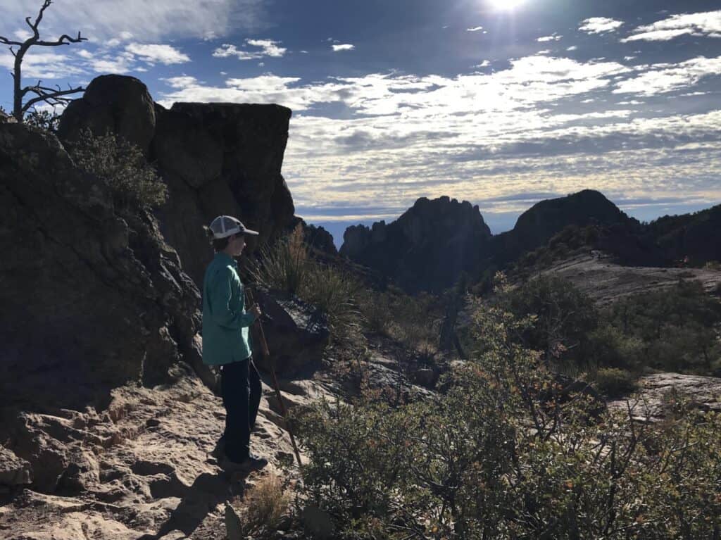
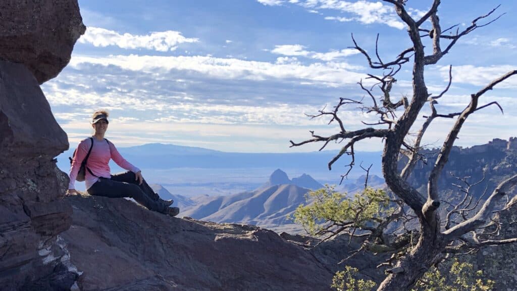
The lost mine trail is one of my absolute favorites And my top pick for the best family hiking trails in Big Bend. It is gorgeous all the way up and back down. You will enjoy 360-degree views at the top looking over mountains, valleys and Mexico! Parking is extremely limited, so I highly recommend you start early. During busy times, plan to arrive no later than 7am.
Ladies…if you are looking for a hiking backpack, check out The BEST Hiking Backpacks For Women. We've done all of the research,compared, and reviewed all of the top backpacks!
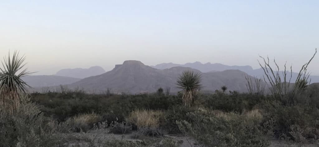
You will enjoy watching the sun spread out across the mountains as you climb (that first picture up there was taken on this trail). In the heat of the day, you will be exposed to the sun for most of this trail (another great reason to start early). The trail begins with a slight incline in the trees, then it opens up to reveal the beauty that surrounds you and the trail gets steeper as you reach the top. The entire trail is so beautiful — I think I took about 100 pictures while hiking this one.
Details – Lost Mine Trail
Where to park/start Lost Mine Trail: There is a SMALL parking lot at mile marker 5.1 on Basin Road. Get there early. Vehicles parked on the side of the road will be ticketed. If this lot is full, there are a couple of other small lots as you continue up Chisos Basin Road, but you will add considerable length to your hike.
Length of Lost Mine Trail: 4.8 miles total (out and back)
Difficulty: of Lost Mine Trail: Moderate
Lost Mine Trail Elevation Change: 1,099 feet
Lost Mine Trail Tips: There are no restrooms at the trailhead or on the trail. It also can be very windy at the top on the ridge, so just be careful.

WHERE TO STAY NEAR BIG BEND
Enjoy amazing mountain views, the gorgeous night sky & privacy! This Airbnb is only 6 miles from the entrance of Big Bend National Park and 1.3 miles from Terlingua Ghost Town. The home is hosted by a super host & has awesome reviews from previous guests. (Photo courtesy of Airbnb)
The Window Trail (aka: the best trail to see bears in Big Bend)
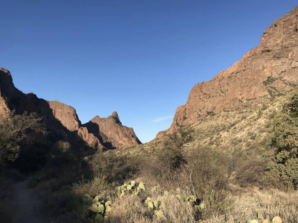
This is the hardest and longest trail on this list, but it is very doable. Just take your time and pack plenty of snacks and water. The Window Trail starts up high near the visitor’s center at Chisos Basin and descends into the valley. So, you’ll be going downhill on the way out and uphill on the way back.
This trail is in the sun for about 1/2 the way down, then shaded the other half. The steepest parts on your way down are the first mile and then the last 1/4 mile (and vice versa coming back up). This is why I say it’s the hardest. You will already be a bit tired on the way back and the steepest part will be your last mile and it is in full sun.
🥾PRO TIP: Make sure you have a great pair of desert hiking shoes before you hit the trails!
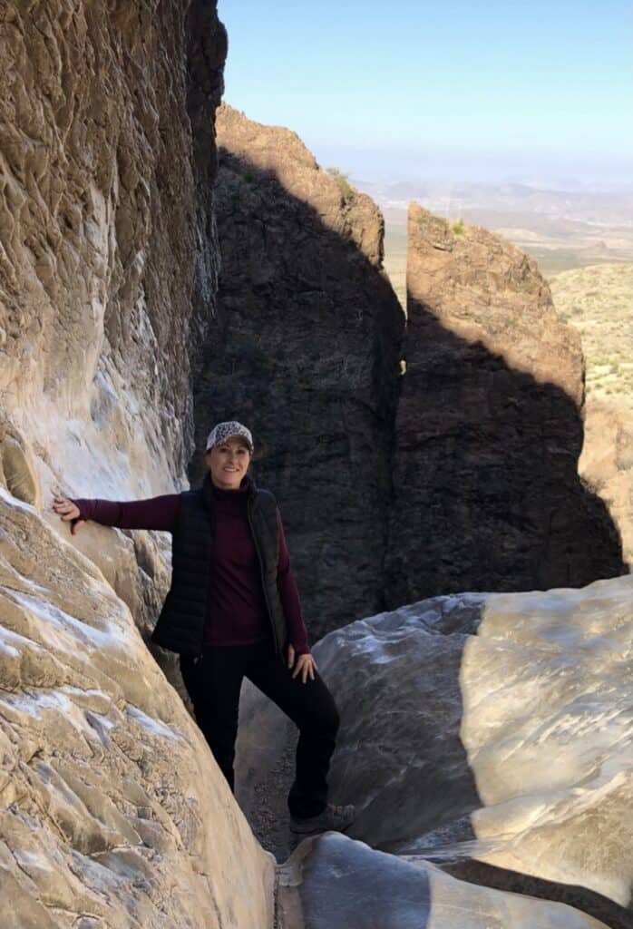
This is a beautiful trail that runs along the creek (when there is water running). Rock cliffs tower above you as you descend deeper into the valley. Once you reach the end, there is an other worldly drop off where water has run over the cliff edge turning it into a smooth gradual drop off. It looks so cool and provides a perfect place to take pictures and rest before you head back up.
BE CAREFUL
The rocks under foot have been worn smooth, and they are slick. Don’t get too close to the edge. There is nothing there to keep you from taking a tumble. Give your kids a pep talk about this before you get to the end. The trail will change drastically as you get close to the end (smooth winding rocks with stairs — you’ll know when you get there, I promise). When you get to this point, call smaller kids to you and make them stay close to you to avoid them running ahead.
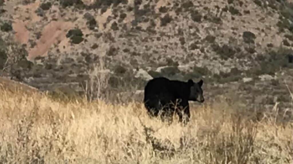
This is a popular trail to spot bears in Big Bend! Apparently, there is a family of bears that live on/near the trail and people see them all the time. Click HERE to read what the park says about bear safety. We were lucky enough to see a bear from a safe distance. He/she did not seem the least bit concerned with us. For the most part, if you keep your distance and don’t try to approach them, you should be fine (in my completely un-expert opinion).
Details – The Window Trail
Where to park/start The Window Trail: Park at the lot for the Visitor’s Center/Chisos Mountain Lodge. This is a very popular trail and there are many other things to do around the trailhead, so again, I’d get there early. We arrived at 7:30am and there were a few spots left.
You can also choose to park at the Chisos campground and begin the trail there (between campsite 49 and 51). This will knock off about 2 miles of the steep part of the trail.
Length of The Window Trail: 5.6 miles total (out and back)
Difficulty: of The Window Trail Moderate
The Window Trail Elevation Change: 948 feet
The Window Trail Tips: The main trailhead is near the Visitor’s Center, restaurant and Chisos Mountain Lodge. There are restrooms and gift shops there as well. If you are there during a rare wet period, the creek may be flowing and you will need to cross it a couple of times while on the trail (but it is unlikely to be deep).
Need a gift for a hiking-loving man? Click HERE to check out the BEST hiking gifts for him!
Santa Elena Canyon Trail
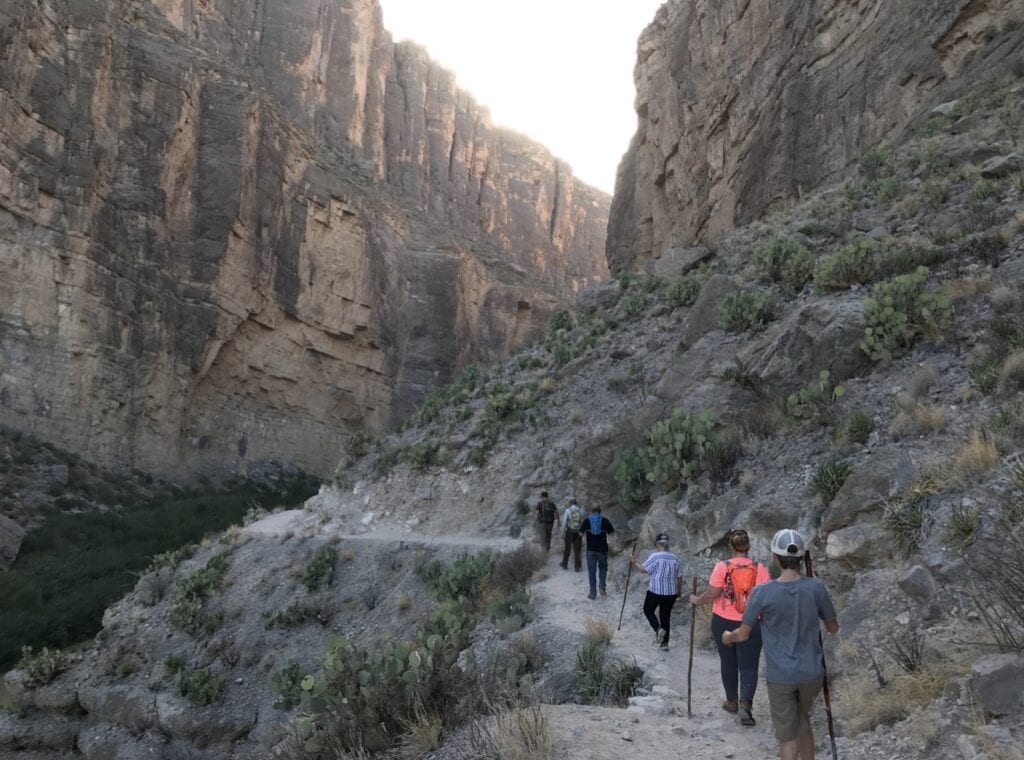
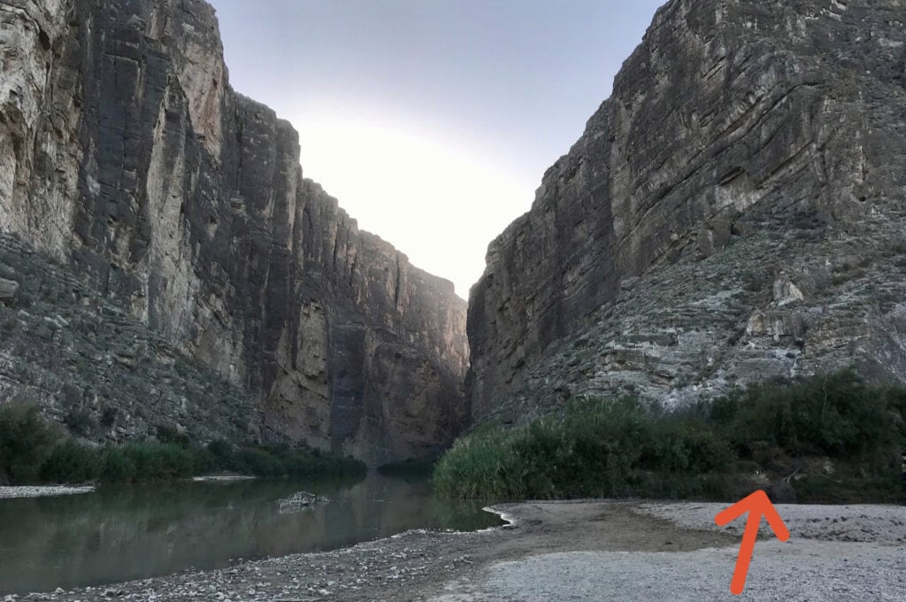
The trailhead is marked, but it soon opens up and may be hard to know where to go if there aren’t a bunch of other people around. When the trail opens up, go to your right. You will need to cross Terlingua Creek to get to the other side of the trail (if you look right, you should see where the trail goes up the hill — stairs and rails and there is a small brown hiking sign).
👍ARE YOU TRAVEL OBSESSED? Join ‘Our Travel Obsession' Facebook group!
When we were there, the creek was low, and we were able to cross mud, rather than wading in the water, but it was thick mud! Many people were choosing to cross through the water, which was chilly and about knee-deep. Either take off your shoes & socks or wear water shoes.
The trail will go up after the creek, then back down into the canyon and to the Rio Grande. It’s a beautiful short trail.
Details – Santa Elena Canyon Trail
Where to park/start Santa Elena Canyon Trail: There is a small parking lot at the trailhead at the end of Ross Maxwell Scenic Drive. We arrived in the afternoon and were able to find parking.
Length of Santa Elena Canyon Trail: 1.7 miles total (out and back)
Difficulty of Santa Elena Canyon Trail: Moderate
Santa Elena Canyon Trail Elevation Change: 610 feet
Santa Elena Canyon Trail Tips: There are restrooms at the trailhead.
As you come into the park on 118, you can choose to take Old Maverick Road on your left, right after the guard shack. This will turn into a bumpy & dusty dirt road, but it is a much shorter drive than taking Ross Maxwell Scenic Drive and it takes you straight to the parking lot. IF you are comfortable driving on gravel roads, you might choose this option to save some driving time. If you aren’t comfortable, don’t go this way — take the longer Ross Maxwell route.
Closed Canyon Trail (Big Bend Ranch State Park)
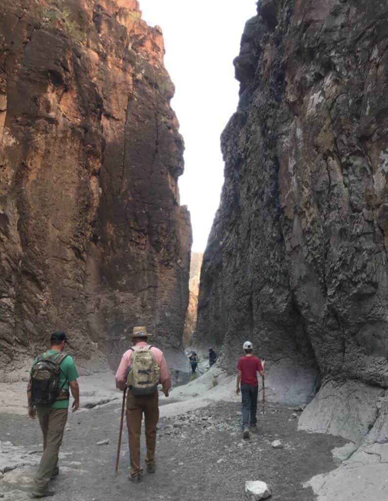
Ok, this trail is NOT in Big Bend National Park, but it’s such a great trail I had to include it. Closed Canyon is in Big Bend Ranch State Park (about 40 miles from BBNP). There are a couple of reasons that I recommend this hike (this is my recommendation for the best hike to do with kids at Big Bend).
First, it is a relatively easy & short hike. Second, it is an awesome canyon hike. It’s a narrow trail with the canyon walls on either side of you and it’s absolutely gorgeous. I truly think you are doing yourself a dis-service if you come all the way to Big Bend and you don’t do this hike. Bonus: you’ll be in the shade almost the whole time (which definitely makes it one of the best family hiking trails in Big Bend).
Finally, you should do this hike because the road getting to Closed Canyon is full of beautiful mountain scenery. There are so many spots to stop off and take pictures. The road follows the Rio Grande most of the way and the mountains of Mexico are RIGHT THERE! Plus, you can stop and explore the town of Lajitas (including the world-famous golf resort & spa) and Terlingua Ghost Town.
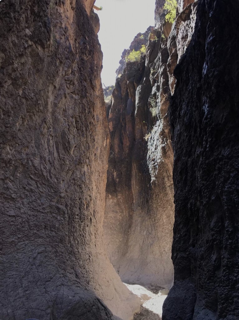
Details – Closed Canyon Trail
Where to park/start Closed Canyon Trail: Head out of the park on 118. Then, take a left on 170 at Terlingua. You'll drive about 22 miles past the Barton Warnock Visitor’s Center. Watch for signs and you will see a parking lot on the left for Closed Canyon Trail.
Length of Closed Canyon Trail: 1.8 miles total (out and back)
Difficulty of Closed Canyon Trail: Moderate
Closed Canyon Trail Elevation Change: 400 feet
Closed Canyon Trail Tips: The trail is called “CLOSED Canyon Trail.” It is not closed. Some people seem confused by this, so I thought it was worth a mention. This is a perfect half-day trip out of the National Park and you’ll see so much more of southwest Texas! Do not enter the canyon if there is a chance of rain. Flash floods can happen fast. Many parts of the trail are covered with dust/rock that is similar to walking in sand.
And there you have it! My list of the top trails to hike in Big Bend National Park (and Big Bend Ranch State Park). If your family loves to hike, you can’t go wrong planning a family vacation to Big Bend! There are tons of day hikes to choose from. These are my pics for the best family hiking trails in Big Bend. Be sure to check out My Top 14 Hiking Essentials before your trip.
Need a place to stay? Make sure you read Where To Stay In Big Bend to see my top recommendations. If you love hiking & National Parks, check out 4 Must Do’s In Yosemite National Park!
Until next time…
Until next time…

About The Author
My mission is to inspire and empower families to prioritize travel now, creating unforgettable memories and deeper connections with their loved ones.
I provide guidance and practical solutions to help busy parents integrate travel into their lives, fostering joy, fulfillment, and stress-free adventures. Don’t wait until it’s too late; the time to travel is now.
Learn more about me & My Travel Obsession here.
My Favorite Travel Booking Apps & Websites
⭐MY TRAVEL OBSESSION:
- Products & Services – My Travel Obsession's travel planning products, services, and freebies!
- What To Pack – See all of my personal favorite travel items.
- Travel Resources – Resources that I use most when planning, booking & traveling.
🏡FOR FINDING GREAT PLACES TO STAY:
- VRBO – My #1 recommendation for family-friendly lodging options.
- Expedia – My favorite for hotel bookings.
🚗FOR CAR & RV RENTALS:
- Discover Cars & Sixt – My favorite sites for rental cars worldwide.
- Turo.com – Rent a car from an individual owner – It's like VRBO for cars!
- RVShare – Rent an RV for your next family road trip!
🚁FOR ACTIVITIES, EXCURSIONS, & TOURS:
- Viator & Get Your Guide – The best sites to find and book activities & excursions.
- Gypsy Guide – An AWESOME audio tour app. ALWAYS check to see if they have a tour available.
🩺FOR TRAVEL INSURANCE:
- SafetyWing – The lowest-cost travel insurance out there. Several options starting as low as $42 for 4 weeks of coverage.
✈FOR FINDING GREAT FLIGHT DEALS:
- Going (formerly Scott's Cheap Flights) – My #1 recommendation for saving big $$$ on flights. Sign up for a free 14-day trial.
🥾FOR HIKING:
- AllTrails – THE APP for hikers. I recommend paying for the pro version so you can use the navigation feature while hiking.
Once you're done here, head to the homepage to explore or jump to one of these categories: Texas Travel ~ US Travel ~ International Travel ~ Travel Tips & Tricks ~ Travel Gear & Gadgets ~ What To Pack ~ Travel Planning ~ Shop